2 - Planning - A dual challenge
Contributors – Julia Pitts and Kirsten Miller
Last Updated – March 2009

[2.1] Introduction
The introduction of self-government for the ACT in 1988 created a situation where the Commonwealth government and the ACT government share responsibility for the future development of Canberra and the territory. This chapter attempts to explain the two related, yet distinct, planning systems.
All land in the territory belongs to the Commonwealth. However, pursuant to the Australian Capital Territory (Planning and Land Management) Act 1988 (Cth) (Planning and Land Management Act), land within the territory is divided into two categories:
· national land which is declared by the Commonwealth minister to be national land under s.27 of the Planning and Land Management Act and is managed by the National Capital Authority (NCA)
· territory land which is the remainder of the land that has not been declared national land and is managed by the ACT Planning and Land Authority (ACTPLA).
The Planning and Land Management Act also provides for 'designated areas' which have the special characteristics of the national capital (s.10) and for areas (other than designated areas) which may be subject to 'special requirements' where it is desirable in the interests of the national capital. Designated areas and areas subject to special requirements include both national land and territory land.
Under this complex and overlapping planning regime the NCA has planning responsibility for designated areas. The designated areas and any conditions for the planning and development of these areas are set out in the National Capital Plan (NCP), which is administered by the NCA. Areas (other than designated areas) which may be subject to 'special requirements' are also set out in the National Capital Plan. The development of these areas must be in compliance with the special requirements specified in the NCP. Developments on territory land may require approval from the NCA or other Australian government agencies.
The system of land tenure in the ACT is leasehold, which differentiates the capital territory from the rest of Australia, is a factor in the planning of Canberra, and is discussed below.
[2.2] Leasehold system
The Commonwealth owns all land in Canberra. Unlike other cities in Australia, Canberra does not have freehold ownership of land; instead, there is a leasehold system. People buy the right to use leased land for a fixed term, usually ninety-nine years.
The Commonwealth ensured that the form of land tenure in the ACT would be different when it adopted the Seat of Government (Administration) Act 1910 (Cth). Section 9 of that Act states '…no Crown lands in the territory shall be sold or disposed of for any estate of freehold…'. Leasehold tenure was adopted so that speculation in undeveloped land could be avoided, and future increases in the value of land remained in the public purse.
The leasehold system also has planning advantages. The government, being the landowner and responsible for development decisions, can try to ensure that planning and development policies are implemented in an orderly and efficient manner. The aim is to avoid the problems apparent in systems used in other states, such as fragmented development fronts and mismatches between the demand for amenities and their provision.
The division of land into national land and territory land is also relevant to the leasehold system. The Commonwealth is responsible for leasing arrangements and management of national land and the ACT is responsible for leasing arrangements and management of territory land. However, there is a complication. Some territory leases may be in designated areas, in which case there is a shared jurisdiction, although outcomes are subject primarily to the NCP and the NCA's wishes.
Regardless of which type of land is involved, it is essential to consider the provisions of the lease to decide whether or not it permits a particular development proposal to go ahead. The lease contains a permitted use clause that will restrict the purposes for which land may be used and many leases contain other provisions that may affect the design and siting of a development. In some cases it may be necessary to vary the provisions of the lease before a development project can be approved.
Permitted use clauses of leases of land managed by ACTPLA can be varied by lodging a development application with ACTPLA, following the procedures discussed in Chapter 3 at [3.3]. Permitted use clauses of leases of land managed by the NCA can be varied by making an application to the NCA. There is no special form for such an application.
[2.3] Commonwealth planning responsibility
The Commonwealth's planning responsibility relates to Canberra as a national capital. It is established through the NCP, which describes the broad pattern of land uses that can be adopted in the development of the ACT. This ensures that Canberra broadly retains the characteristics with which it was originally planned. It is managed by the NCA, under the Planning and Land Management Act.
[2.3.1] National Capital Plan
The object of the NCP is to ensure that Canberra and the territory are planned and developed in accordance with their national significance (s.9 Planning and Land Management Act). In essence, the NCP is a blueprint for the future development of Canberra. It provides a framework of land uses within which the Territory Plan (TP) sits, as well as managing those aspects of Canberra and the territory that are special to the national capital role.
The key matters of national significance include:
· the pre-eminence of the role of Canberra and the territory as the national capital
· preservation and enhancement of the landscape features that give the national capital its character and setting
· respect for the key elements of Walter Burley Griffin's formally adopted plan for Canberra
· creation, preservation and enhancement of fitting sites, approaches and backdrops for national institutions and ceremonies as well as national capital uses
· development of a city which respects both environmental values and reflects national concerns with the sustainability of Australia's urban areas.
More specifically, as stated in the second reading of the Planning and Land Management Bill 'the purpose of the National Capital Plan is to ensure that the Commonwealth's national capital interests in the Territory are fully protected, without otherwise involving the Commonwealth in matters that should be the prerogative of the Canberra community'.
The 'national interest' in the capital is reflected throughout the territory and is essential to the development of the ACT as the garden city and bush capital, and the symbolic centre of Australia.
[2.3.2] Role of the National Capital Authority
The NCA is established under s.5 of the Planning and Land Management Act. Its functions include preparing and administering the NCP, reviewing the NCP, proposing amendments where necessary, and fostering an awareness of Canberra as the national capital. While the NCA is responsible for developing and reviewing the NCP, any amendments to the plan must be approved by the Commonwealth minister responsible for territories and are disallowable by the Commonwealth Parliament (Division 2 of Part III of the Planning and Land Management Act).
The NCA is also responsible for the detailed planning and development controls in what are called designated areas (s.10). Designated areas are areas of particular importance to maintaining the special characteristics of the national capital, comprising:
· Canberra's system of inner hills and ridges, for example, Mt Ainslie, Black Mountain, Red Hill and Mt Pleasant
· the eighteen main avenues and six approach routes to the city, for example, Northbourne Avenue, Adelaide Avenue, State Circle, Kings Avenue, Canberra Avenue, and the Barton, Federal and Monaro Highways
· the Central National Area, including the Parliamentary Zone and surrounds
· the diplomatic areas
· Lake Burley Griffin and its foreshores
· the main national institutions and symbols of Commonwealth governance.
[2.3.3] Main features of the NCP
The NCP sets out planning principles and policies for the maintenance and enhancement of the character of the national capital, plus standards and aesthetic principles to be adhered to in the development of Canberra and the territory. It also contains detailed conditions of planning, design and development for designated areas because of their particular importance to the special character of the national capital. The NCP is set out with an introduction, three main parts and a set of appendices. Maps are included as figures when relevant.
Introduction
The introduction explains the development of a planning system for Canberra and the establishment of the NCP and the NCA. It also explains the concept of national significance as well as outlining the different elements of the plan.
Part 1: Principles and policies, designated areas and special requirements
Part 1 establishes broad principles and policies that set out permitted uses for different land use categories. These categories include:
· urban areas
· broadacre areas
· hills, ridges and buffer spaces
· river corridors
· mountains and bushlands
· rural areas.
For each category the NCP sets out planning policies, including a range of permitted uses. The land use policies contained in the TP are then chosen from this range of permitted uses.
Part 1 also details general policies covering national and arterial roads, location of Commonwealth employment, heritage issues and other relevant matters of broad policy.
As well as defining the designated areas as discussed above, Part 1 also identifies special requirements for areas outside the designated areas. These take effect through provisions of the TP as discussed below. Areas where special requirements apply include national land not included in designated areas, the Australian Institute of Sport, Civic, Murrumbidgee and Molonglo River corridors, Namadgi National Park and many more.
Part 2: Administration and implementation
Part 2 details provisions for administration and implementation of the NCP, including the relationship to the TP and the development and management of national land.
Part 3: Background notes
These notes cover the future of the capital, Canberra and the region, Commonwealth funding and the national capital, including statistics, graphs and pie charts.
Appendices
There are twenty-four appendices relating to a variety of issues including Lake Burley Griffin Technical and Management Guidelines (Appendix J), Civic Centre Townscape Conditions (Appendix L), West Belconnen (Appendix W) and Approach Routes (Appendix X).
[2.3.4] Amending the NCP
The NCA is required to keep the NCP under review and to prepare amendments where necessary (s.6). In doing so, the NCA must consult ACTPLA, and make the draft amendment available for public comment (see below for more detail). When this consultation is finalised, the NCA may either revise the draft amendment or simply submit the amendment, and a report on the consultation, to the minister for approval. The responsible Commonwealth minister at the time of writing was the Minister for Home Affairs.
The minister, in turn, can either decide to approve the draft amendment, or refer it back to the NCA for further consultation or specific amendment (s.19). Once the minister approves the draft amendment, notice of this approval must be advertised in the Commonwealth Gazette, and it is now also advertised on the NCA's website. The amendment takes effect upon publication of this notice of approval. The amendment is then laid before each House of the Commonwealth Parliament for six sitting days, within which time either House can disallow it in whole or in part (s.22).
The minister may refer draft amendments to the Joint Standing Committee on the National Capital and External Territories for inquiry and report (see [2.3.5] Public participation in the amendment process for more detail).
Under s.16 of the Planning and Land Management Act, the minister may certify a draft amendment for six months, pending consideration of the draft amendment. Re-certification for one or more periods of six months is also possible. Certification simply gives temporary effect to a draft amendment, that is, the draft amendment is considered to apply for the period of certification, whilst the consultation processes described above occur.
It is worth noting that the Planning and Land Management Act makes specific provision for a deadlock between the NCA and the ACTPLA concerning draft amendments (s.20A). The minister, in consultation with the executive, can direct the NCA either to disregard ACTPLA's objections, or to vary the amendment, in whole or in part, to accommodate the objection. Such a direction must be notified in the Commonwealth Gazette and laid before both Houses of Federal Parliament within six days. To date, no such action has been required.
[2.3.5] Public participation in the amendment process
The NCA is required to consult the public on draft amendments, and must advertise this consultation in the Commonwealth Gazette and the Canberra Times (s.15). It also appears on the NCA website. Draft amendments are available for public inspection at a place specified in the notice, as well as on the NCA website. The Planning and Land Management Act only requires that the NCA provide a 'reasonable period' for public comment.
Many people provide written comments in order to object to a draft amendment. In most cases, it is useful to provide such comments within the context of the objectives of the NCP and the importance of national significance. Once the NCA has received comments, it is required to consider them, and also to provide a report on the consultation to the minister, for consideration during the approval process (ss. 15(2) and 18).
People may also have an opportunity to comment on a draft amendment if it is referred to the Joint Standing Committee on the National Capital and External Territories for inquiry and report. This often involves a call for submissions and may involve an opportunity to give evidence before the committee.
[2.4] The Territory's planning responsibility
[2.4.1] Introduction
The Australian Capital Territory's planning responsibility relates to Canberra as a city. It is established through the Territory Plan (TP), managed by the ACT Planning and Land Authority (ACTPLA), under the Planning and Development Act 2007 (Planning Act).
Like all Territory legislation the Planning Act has no effect to the extent that it is inconsistent with the NCP, but under s.11 of the Commonwealth Planning and Land Management Act, is taken to be consistent with the NCP to the extent that it can operate concurrently with it.
[2.4.2] Sustainable development within the territory
Throughout the Planning Act and the TP there is a strong emphasis on sustainable development. The object of the Planning Act (s.6) is to provide a planning and land system that contributes to the orderly and sustainable development of the ACT, consistent with the social, environmental and economic aspirations of the people of the ACT; and in accordance with sound financial principles.
Sustainable development in this Act means (s.9) the effective integration of social, economic and environmental considerations in decision-making processes, achievable through implementation of the following principles:
· the precautionary principle— if there is a threat of serious or irreversible environmental damage, a lack of full scientific certainty should not be a reason to postpone preventative measures
· the inter-generational equity principle—ensure that the health, diversity and productivity of the environment is maintained or enhanced for the benefit of future generations
· conservation of biological diversity and ecological integrity
· appropriate valuation and pricing of environmental resources.
Under s.12 ACTPLA is required to exercise its functions in a way that, as far as practicable, gives effect to sustainable development. In addition there are several clauses within Part 5 of the Planning Act which require 'sustainability principles' and 'principles for sustainable development' to be taken into account in administering the Act.
[2.4.3] The Territory Plan
The TP, like the NCP, is established under the Commonwealth Planning and Land Management Act (s.25). The object of the TP is to ensure, in a manner not inconsistent with the NCP, the planning and development of the ACT provide the people of the ACT with an attractive, safe and efficient environment in which to live, work and have their recreation (s.48 of the Planning Act). Section.50 of the Planning Act states that nobody, that is, the territory, the executive, a minister or a territory authority, can do or approve an act that is inconsistent with the TP.
The Planning Act also requires that the TP contain a statement of strategic directions (s.51) which may contain planning principles covering areas of national, regional and territory interest, including principles for sustainable development (s.52). The function of the statement is: to contain broad strategic principles to guide long term planning for the ACT; guide the preparation and making of variations to the territory plan; and guide environmental impact statements, planning reports and strategic environmental assessments. Chapter 5 of the Planning Act sets out the framework for the TP, which must include the following:
· a statement of strategic directions
· objectives for each zone
· development tables
· codes
· a map (the territory plan map).
The territory plan map must set out, in map-form, zones and precincts in the ACT (s.56). The map is probably the most used part of the TP. It identifies the geographical application of the particular policies that are set out in the TP showing by shading which policies correspond to which area.
Copies of the TP are available through the ACT government shopfronts and libraries (see Contacts list at the back of this book). However, as the TP is constantly being varied, it is best to check ACTPLA's website to guarantee that you are looking at the most up-to-date version (see ACT Environmental Law Handbook Contacts).
It is worth noting that the territory plan may, but need not, identify future urban areas and include the structure plans that apply to those areas; identify areas of public land reserved in the plan (for example national parks and nature reserves) and make provision in relation to affordable residential housing.
The TP is dived into three volumes. Volume 1 contains the map, the statement of strategic directions and the zones. Volume 2 contains the general codes and overlays as well as the definitions and Volume 3 contains the structure plans, concept plans and development codes for future urban areas.
Statement of Strategic Directions (Part 2 of Volume 1)
The statement of strategic directions gives effect to the objects of the TP. It provides a policy framework and gives guidance on the more specific policies in the TP. The statement of strategic directions comprises two sets of principles, sustainable development and spatial planning and urban design.
Zones (Part 3 to 9 of Volume 1)
Land in the Territory is divided into zones. This is designed to provide a system of land uses that can be applied to particular land. Parts 3 to 9 set out the seven zones, most of which have sub zones.
Zones include:
· residential (Part 3)
· commercial (Part 4)
· industrial (Part 5)
· community facility (Part 6)
· parks and recreation (Part 7)
· transport and services zone (Part 8)
· non-urban zone (Part 9), this includes the sub zones broadacre, rural, hills, ridges and buffer, river corridor and mountains and bushlands.
Each zone includes the specific objectives for the particular zone, a development table and applicable codes. The zone objectives set out the broad policies for that particular zone. The development table specifies whether a particular type of development is exempt, prohibited or assessable and the minimum assessment track for development applications in that zone (see Chapter 3 at [3.4.4], [3.4.5] and [3.4.6]). The development table also sets out the applicable codes.
Codes identify planning design and environmental controls for differing land uses, development types, zones and precincts. There are three different types of codes, precinct codes, development codes and general codes. Precinct codes apply to geographical areas which may include more than one zone or parts of zones, development codes apply to specific zones or development types and general codes may apply to defined development types and/or planning and design issues throughout ACT and to territory authorities.
Each zone is coloured a separate and distinctive colour on the TP map.
It should be noted that the TP does not imply any right to proceed with a particular development, even if it falls within a permitted land use. A development application (see [3.3]) is usually still required, and environment impact assessment (see ACT Environmental Law Handbook Chapter 4) may also be required.
Precinct Codes (Part 10 of Volume 1)
Precinct codes apply to geographical areas which may include more than one zone or parts of zones. For example, Northbourne Avenue Precinct Code at 10.1.
General Codes (Part 1 of Volume 2)
General codes may apply to defined development types and/or planning and design issues throughout the ACT and to territory authorities. The general codes include:
· parking and vehicular access
· bicycle parking
· access and mobility
· crime prevention through environmental design
· community and recreation facilities location
· communications facilities and associated infrastructure
· signs
· water use and catchment
· home business
· waterways—water sensitive urban design
· planning for bushfire risk mitigation
· residential boundary fences.
Overlay provisions (Part 2 of Volume 2)
Part 2 of volume 2 details more specific policies/purposes for different areas that are then marked on the TP. Overlays identify special attributes of land that are sensitive to the effects of development or may constrain development. Overlay provisions relate to:
· public land reserves (except urban open space)—including wilderness areas marked 'Pa', national parks 'Pb', nature reserves 'Pc', special purpose reserves 'Pd', urban open space 'Pe', cemeteries or burial grounds 'Pf', water supply catchments 'Pg', lakes 'Ph', and sport and recreation reserves 'Pi'
· precincts—these are marked with a blue border with a 'P' including Northbourne Avenue, rural villages, inner north, plantation forestry and clearance zones—many of the precincts will have a Precinct Code associated with them that provide relevant development controls.
· special requirements—areas subject to special requirements under the NCP are marked with a red border and an 'S' or shown by black dashed lines flanking a main avenue or approach route, for example, Northbourne Avenue
· future urban areas—areas which are identified for future urban development are marked on the map by a blue border with 'FUA'—The principles and policies for the development of this land are set out in a structure plan, at Part 1 of Volume 3 of the TP)
· draft variations—land the subject of a draft variation which has interim effect is marked on the map by a blue border with a 'V'
· urban open space zones (not public land)—these are marked on the map by a blue border with a 'X'
· inter-town public transport routes—these are marked by circles
Definitions (Part 3 of volume 2)
Part 3 of Volume 2 sets out the definitions of development and terms used in the TP.
Future Urban Areas (Volume 3)
Volume 3 sets out structure plans, concept plans and development codes for areas which have been identified for future urban development, for example, Crace, Forde and Jacka. Structure plans set out the principles and policies for development of the area. The concept plan applies the principles and policies in the structure plan and guides the preparation and assessment of development in these areas and guides the assessment of development in these areas when the areas cease to be future urban areas.
[2.4.4] Role of ACTPLA
Section 12 of the Planning Act sets out ACTPLA's functions and requires that it must exercise these functions in a way that, as far as practicable, gives effect to sustainable development. There are 15 functions listed in s.12(1)(a) to (o), including: prepare, administer, review and propose amendments to the TP; plan and regulate development; advise on planning and land policy; manage leases; decide development applications (see [3.3]); regulate the building industry; take compliance and enforcement action; review its own decisions; promote public education of the planning system; and provide opportunities for community consultation.
[2.4.5] Varying the Territory Plan
If an area of land is needed for a use that is inconsistent with the current land use policy, ACTPLA can initiate a variation to the TP by preparing a draft variation. As part of this process, under s. 61, it must inform the minister that it is preparing a draft variation and consult with a range of entities: the NCA; the Heritage Council (see [9.2.2] Heritage Council); the Conservator of Flora and Fauna (see [5.3.2] The conservator and the service, [7.2] Creating public land, [7.3] Managing public land, [7.5] Public participation, and [7.8] Licences and leases over public land); and the Environment Protection Authority (see [10.2.5] The Environment Protection Authority). ACTPLA must also consider any relevant environmental assessments or reports (see ACT Environmental Law Handbook Chapter 4) and must make the variation available for public comment (for more detail see [2.4.6] Public participation in the variation process).
After the end of the consultation period ACTPLA may revise or withdraw the draft; any withdrawal is a notifiable instrument (s.68). ACTPLA must also publish the withdrawal in a daily newspaper on the same day, or as soon as practicable. In revising or withdrawing a draft variation ACTPLA must consider written comments (including consultation comments) about the draft variation received from any entity. In addition, the authority may revise the variation to correct a formal error at any time before the draft is given to the minister.
After the consultation and under s.69 of the Planning Act, ACTPLA must give the draft plan variation to the minister for approval, together with background papers relating to the variation; and a written report setting out the issues raised in any written comments (including public consultation comments) about the variation; and a written report about its consultation with the above mentioned authorities; and a copy of any written document given to the minister by the NCA in relation to the draft plan variation. If the draft plan variation would, if made, be likely to affect unleased land or leased public land, the report must also include the consultation with each custodian for the land likely to be affected (s.61(b)(v)).
ACTPLA must prepare a notice (a public availability notice which is a notifiable instrument ) stating that the documents mentioned, including the draft plan variation, are available for public inspection during office hours during the period, and at the places, stated in the public availability notice (s.70). During this period government authorities must not do or approve anything that would be inconsistent with the territory plan if it were varied in accordance with the draft plan variation (s.72), if the notice states that this section is applicable.
[2.4.6] Public participation in the variation process
The public's first opportunity for participation in the process is when ACTPLA prepares the mandatory consultation notice stating that copies of the draft plan variation and the background papers are available for public inspection and purchase at stated places, usually ACT government shopfronts and libraries, during the consultation period, which must not be less than 15 working days (s.63).
It invites people to give written comments (consultation comments) about the draft plan variation to ACTPLA at a stated address during the consultation period; and stating that copies of any written comments received from the public and the NCA will be made available (unless exempted) for public inspection for a period of at least 15 working days, starting on the day after the day the consultation period ends, at stated places.
ACTPLA may (by an extension notice), extend or further extend the consultation period. The consultation notice and any extension notice are notifiable instruments: and must be notified under s.4 of the Legislation Act. ACTPLA must also publish the consultation notice and any extension notice in a daily newspaper. A consultation notice must state whether or not s.65 applies in relation to the draft plan variation, or part of the draft variation; and where further information about the draft plan variation can be found. Section 65 in effect gives the draft variation interim effect. If it is stated that s. 65 applies it means that the Territory, the Executive, a Minister or Territory authority must not (for a certain interim period) do or approve the doing of anything that would be inconsistent with the Territory Plan if it was varied in accordance with the draft variation.
The public's second opportunity for participation arises if a draft variation is referred under s.73 of the Planning Act to a relevant Legislative Assembly committee, such as the Planning, Public Works and Territory and Municipal Services Committee. The minister must give a copy of the documents given to the minister under s.69, listed above, to that committee. The committee will usually call for written comments on the draft variation and may hold public hearings. Public hearings are usually held for the more high profile variations.
Comments to the committee may take many forms, ranging from a simple letter of objection through to a detailed analysis of the 'problems' with the draft variation. It is important to mention you would like the opportunity to discuss the issues further at a public hearing. Of course, it is not necessary to be objecting to the draft variation to provide comment; the committee regularly receives comments in support of draft variations.
Once the committee has received submissions and held any public hearings, it prepares a report on the inquiry, including the basis for the inquiry, a summary of comments and submissions made to it, and recommendations to the executive. Sometimes a majority and a minority report are prepared when one of the three members cannot agree with the recommendations of the other two.
The committee is responsible for considering the draft variation and making recommendations to the executive. The executive may then approve the variation to the TP, taking into account the recommendations of the committee. If the executive does not approve the variation, it may refer it back to ACTPLA with directions to, among other things, revise the variation, undertake further consultation, withdraw the variation, or consider any relevant planning report or strategic environmental assessment.
If the minister approves the variation, he has five sitting days within which to table it in the Legislative Assembly (s.79). The Assembly then has ten sitting days in which it can disallow the variation (s.80). This gives interested persons some time in which to lobby Assembly members on whether the variation should be accepted or not. If the variation is not disallowed the relevant minister then sets a day from which the variation is to commence. Notice of commencement is published in the Canberra Times and on the ACTPLA website.
It should be noted that once a variation to the TP has been approved, there is nothing to stop that decision being reversed by another variation, provided it goes through the same process
[2.4.7] Planning strategy
Under s.105 the executive is required to make a planning strategy for the ACT that sets out long term planning policy and goals to promote the orderly and sustainable development of the ACT, consistent with the social, environmental and economic aspirations of the people of the ACT. Its primary object is to promote the development of the ACT as described in s.105.
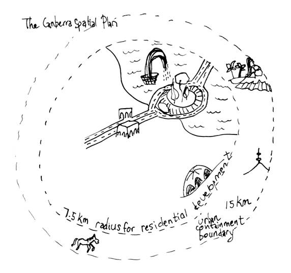
The transitional provisions in the Planning Act provide that the Canberra spatial plan and the sustainable transport plan make up the current planning strategy (s.440). The Canberra Spatial Plan was published in 2004. It is available on the ACTPLA website (see ACT Environmental Law Handbook Contacts). It sets out an integrated spatially based framework for the development of Canberra which is designed to direct and manage urban growth and change. The spatial plan provides a strategic Canberra-wide context within which the TP operates.
The spatial plan is intended to guide the territory in its allocation of resources, such as the use of land and the construction of capital works as well as to inform changes to both the NCP and the TP. The spatial plan does not replace the TP—it is a strategic document to guide more detailed planning.
The key principles underpinning the spatial plan are containing growth, residential intensification, centralising new residential areas, locating employment, protecting biodiversity, good travel connections and sustainable growth of the region.
In relation to the key principle of 'protecting biodiversity' the plan notes that 'the containment of growth within a 15 km radius of the city centre is designed to reduce the potential land take for residential development and also reduce pressure on areas of high conservation value which could otherwise be severely impacted by future urban development.'
In relation to the principles of residential intensification and centralising residential areas, the spatial plan identifies new residential areas, for example, it identifies the Molonglo Valley as an area for future development.
The strategic plan also sets out a number of key goals and objectives and for each of these sets out actions to achieve them, outcomes and monitoring indicators. The key goals are to create and maintain a healthy community, sustain employment opportunities, retain ease of movement and facilitate good travel connections, maintain a unique sense of place, respect the natural environment and ensure fiscal responsibility.
One of the objectives within the goal of respecting the environment is to 'protect and enhance biodiversity through nature reserves and maintaining connectivity between them'. To achieve this the plan states that 'the major river corridors, the urban hills and ridges, and the hills and reserves east and north of Gungahlin that create the main links for wildlife movement and connect into natural areas south and west of the Murrumbidgee River will be protected as wildlife corridors. At a smaller scale the numerous parks, waterways and landscape features in the urban area that provide links between private gardens and nearby bushland areas will also be recognised in planning policy.'
In addition, 'development in the new employment corridor in Majura, Symonston and Jerrabomberra, including around the airport, will take into account the areas of native grassland and habitat for threatened species that are of significant nature conservation value.'
The sustainable transport plan provides the direction and actions to achieve a more sustainable transport system and is designed to ensure integration between transport and land use planning for Canberra.
[2.4.8] Master plans
Master planning allows for detailed planning for a specific area. The master planning process allows for community consultation at a number of steps along the way. This includes public and stakeholder meetings as part of the development of the draft master plan as well as a formal submission process on a final draft master plan. Master plans often result in proposed amendments to the TP to allow implementation of the proposals contained in the master plan.
[2.4.9] Greenfield sites
It is likely that a large number of greenfield sites will be released for development over the next few years.
[2.5] Simplifying the dual system
In 2008 the Commonwealth Parliament's Joint Standing Committee on the National Capital and External Territories conducted an inquiry into the role of the NCA, including inquiring into the administration of the NCP with particular emphasis on the reduction of red tape and duplication of planning functions and harmonisation of planning systems.
The Committee made a number of recommendations to improve the operation of the planning system and reduce the complexity of the dual planning system. In particular, the Committee recommended (recommendation 15) that:
· 'special requirements' be removed from the NCP
· all areas of national land previously subject to special requirements be converted to designated areas
· any areas of territory land previously subject to special requirements, where the Commonwealth has a significant and enduring planning interest, be converted to designated areas until a broader review of the NCP and TP is undertaken to assess whether such areas should be considered for future gazettal as national land.
The Commonwealth government provided a response to the committee's report in December 2008. The government's response indicated that the government accepts recommendation 15 in principle and will consider how best to implement this recommendation.